Stage Projects
Current stage projects
TomTom
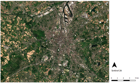
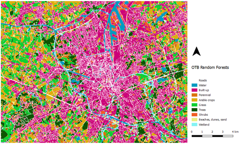
TomTom is exploring how to improve their land cover features through automated processes using the recent enhancements in spatial, spectral and temporal resolution of satellites and the major evolution in machine-learning techniques. Based on the recent article of Inglada et al. (2017), the main goal of the internship consists of getting insight in the potential of the IOTA2 (Infrastructure pour l'Occupation des sols par Traitement Automatique) chain for TomTom's land cover mapping. The IOTA2 process uses the Vector Tools library, the Temporal Gapfilling library and the Orfeo Toolbox for the preparation of reference data, pre-processing of Sentinel-2A time series and Random Forests classification. So far, several maps have been generated using only one cloud-free image with the Orfeo Toolbox. The preliminary trial (see image below) resulted in a map with an overall accuracy of 77.7%. Minority classes such as perennial crops, shrubs, beaches and wetlands lack in precision and recall. Extraction of water, built-up areas, arable crops, grass and trees show great potential. Future goals are exploring Sentinel-2A time series with clouds, experimenting with an OBIA approach and launching the IOTA2 chain instead of manually executing the various steps and scaling the solution to a global solution.
Inglada, J., Vincent, A., Arias, M., Tardy, B., Morin, D., & Rodes, I. (2017). Operational high resolution land cover map production at the country scale using satellite image time series. Remote Sensing, 9(1), 95.
www.tomtom.com

