Thesis projects
Current master projects
Spatial hog deer habitat characterisation to support conservation management
Wim De Schuyter
Partners: WWF Belgium, WWF Cambodia

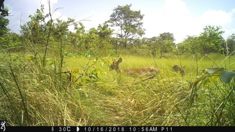
Along the Mekong, across the Kratie province, there is a unique wetland ecosystem that is hosting one of the last wild hog deer populations in Cambodia (observations in 2006 by Maxwell, in 2017 by WWF-Cambodia and in 2018 by Jocque et al.). Steps are being taken by WWF Cambodia in collaboration with WWF Belgium to delineate a protected area and provide a refuge for the hog deer in the Cambodian floodplains of the Mekong River. However, there is little information available on the forest habitat and a spatial characterisation is lacking. Therefore, an explorative research to assess the quality and spatial characterisation of the hog deer habitat is being conducted. This master dissertation should contribute to a multi-criteria decision model that will allow stakeholders to define the core and connectivity zones to facilitate protection and sustainable management of the habitat and the endangered animal species.
Objectives:
1. Identifying the factors that define habitat suitability for hog deer: Literature study and interviewing local people in order to learn what the exact habitat for hog deer is and how they use it and learning what threats are affecting the habitat.
2. Identification of land cover: Literature study and field investigation in order to learn what types of land cover occur in the area. Identifying the main attributes associated with this land cover and the hog deer. Collecting GPS-referenced ground sampling data and creating a detailed supervised land cover classification with Sentinel-2A images (10m resolution, 13 spectral bands). Including a temporal gradient (images at different times and seasons).
3. Characterisation of the hog deer habitat: What is the condition of the present hog deer habitat: degree of fragmentation and disturbance, size, temporal changes, connectivity, etc.
4. Collecting hog deer presence/absence data: Camera trapping in order to locate current populations or confirm absence of hog deer populations in the area.
5. Contributing to a multi-criteria model: Combining 1, 2, 3 and 4 into a model that will allow stakeholders to define the core and connectivity zones to facilitate protection and sustainable management of the hog deer habitat.
Spatial characterization of bird habitat in the Mekong Flooded Forest Landscape in Kratie, Cambodia
Gauthier Snyers
The Mekong Flooded Forest (MFF) Landscape is a 56-kilometer remote section of the Mekong mainstream that passes through the Cambodian provinces of Kratie and Stung Treng. The region is well-known for its unique biodiversity, including flooded forests, trapeangs, deciduous dipterocarp forest and evergreen forest. The MFF is also home to a diverse set of endemic species, of which the iconic Irrawaddy dolphin Orcaella brevirostris and the White-shouldered ibis Pseudibis davisoni, a ‘flagship specie’ in Cambodia are part.
Although the landscape remains essentially rural, many of these species are threatened by habitat loss and are classified as endangered or critically endangered by the International Union for Conservation of Nature (IUCN) red list. In some cases, other factors like hunting, the collection of eggs, or poisoning also reduces their chances of survival.
Since 2008, WWF-Belgium, in collaboration with WWF-Cambodia and other local NGO’s, is aiming to improve knowledge on the habitat of endangered bird species in the MFF. This, in order to allow for evidence-based conservation management. They proposed a new protected area called the Sambour Wildlife Sanctuary (SWS), located between Ou Krieng and Ou Preah, around 80 km North of Kratie city. The sanctuary covers several islands in the Mekong River and extends substantially inland, east and west of the river. It is in this area that several bird species find their nesting place. In May 2018, biodiversity has been researched in this region by the BINCO project and 218 bird species were recorded.
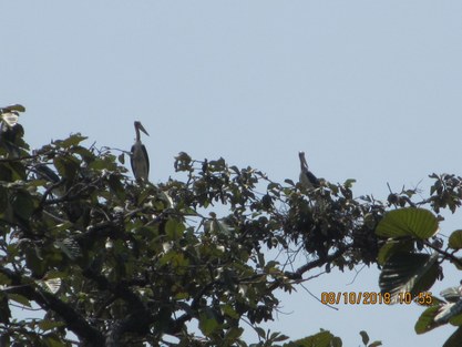
The aim of this research is to improve knowledge on bird habitat by providing land cover and habitat suitability maps for five endangered bird species in the SWS, including:
- The Lesser adjutant Leptoptilos javanicus
- The White-shouldered ibis Pseudibis davisoni
- The River tern Sterna aurantia
- The White-rumped vulture Gips bengalensis
- The Red-headed vulture Sarcogyps calvus
This research uses Sentinel-2 imagery, a free access database provided by the European Space Agency under the Copernicus program. Land cover identification will be completed by change detection, comparing the land cover over several years. Habitat characterization will be conducted using data on bird nest sites and roost trees for the past ten years provided by WWF-Cambodia, together with additional information collected in Cambodia.
Key Objectives:
Identifying the factors that define habitat suitability for bird species in the study area
- Spatial explicit Identification of land cover in study area
- Characterisation of the bird habitat
- Describe waterhole use by birds
- Contributing to a multi-criteria model that will allow stakeholders to define the main conservation nesting habitats
Recently finished master projects
Spatial evaluation of the success of a reforestation project in the Ecuadorian Andes
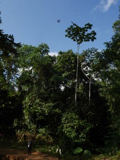
Andean cloud forests are one of the most biodiverse biomes on earth; demonstrated by a large amount of endemic species and an especially high biodiversity index. At the same time, Ecuador is marked by one of the highest annual deforestation rates in the world (around 3% during 1989-2008). Over the last decennia a lot of deforestation has taken place in the Andean forests to provide space for agricultural expansion and grasslands to hold cattle. However, after only a couple of years most of these grasslands stop providing significant yield, due to erosion. Reforestation projects are essential in the re-valorization of these lands, bringing back social, economic and ecological value to the region. In this master thesis the success of a reforestation project in the Pichincha region, set up in 2011 by BOS+ in cooperation with Mindo Cloudforest Foundation, will be investigated. The approach to monitoring the reforested area will be twofold: the reforested terrains will be measured the traditional way with permanent sample plots but will also be monitored using a GIS approach. The reforested areas will be flown over by an UAV equipped with a RGB sensor. From the aerial images a 3D structure will be derived and it will be investigated whether tree height can be estimated out of this structure, which will be compared with the ground measurements. The tree heights of the total reforested area can enhance estimates for the amount of carbon sequestered in the reforested terrains. If proven accurate and reliable, a drone-based approach could increase the scale of monitoring in time and space at a relatively low cost.
Impact of commercialization on the population parameters of Irvingia, a Non Timber Forest Products (NTFP) genus in Cameroon
Jona Vanparys
This thesis aims to study the impact of different degrees of NTFP commercialization on the population of Irvingia (bush mango) trees. Increased pressure on NTFPs has an impact on the population through different processes such as overexploitation, domestication, privatisation,.. An participatory inventory will combine quantitative assessments (measurements of different tree attributes) with local knowledge to assess the actual impact on the target population. Fieldwork took place in Cameroon.
Monotemporal assessment of amount of Acacia’s (individuals, tree groups) and estimation of crown diameter classes of Acacia raddiana in Bou-Hedma National Park, Tunisia
Kevin Delaplace
In this study we focus on the Acacia raddiana forest steppe in Bou-Hedma National Park, Tunisia. A. raddiana is a keystone species in the pre-Saharan Tunisia zone, as it is the only tree persisting on the edge of the desert. The aim of the study is to perform a monotemporal assessment of the amount of Acacia raddiana and their crown diameter classes, with the use of a GeoEye-1 satellite image.
